
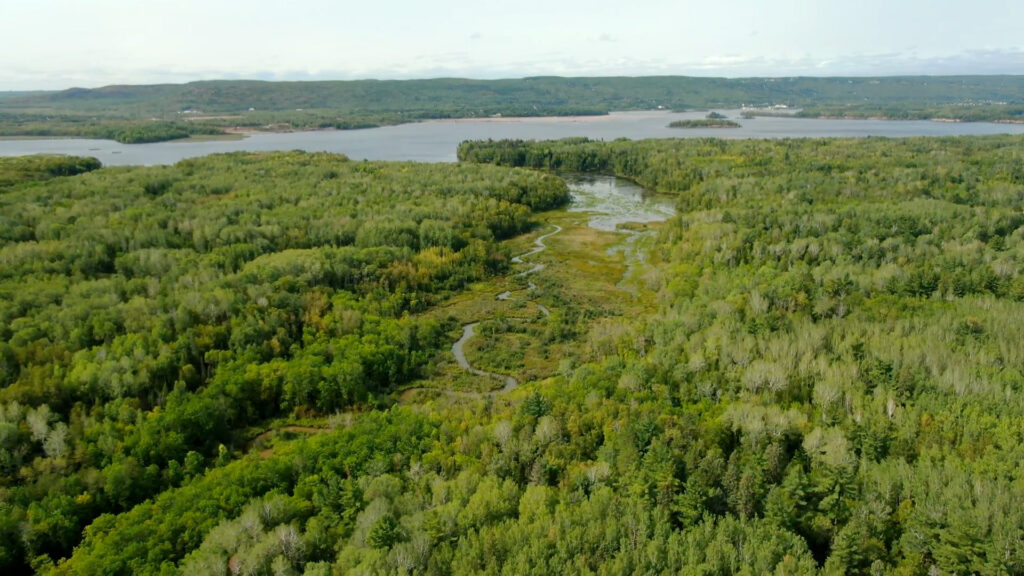
Trails in Superior, Wisconsin


Hit The Trails
Discover the quiet, rugged beauty of northern Wisconsin forests and waterways.
Easy access to Superior city trails and beaches – and the thrill of going all out on terrain groomed for bikes, snowmobiles, skis, horses and ATVs.
Find your trail:
Motorized trails
Find some forest freedom
Dig into the dirt or snow on over 100 miles of maintained summer ATV trails and 400 miles of maintained snowmobile trails—with connectors right in Superior. Plus, access to 50 miles of off-highway motorcycle trails.


Gear Up
Biking
From scenic all-season mountain bike and fat tire adventures to gravel cycling and friendly paved routes, biking options in the Superior area offer a little something for everyone.

Mont Du Lac
5+ miles of single-track loops at Mont du Lac Resort offer leg-burning climbs and screaming descents, with gorgeous views of Jay Cook State Park and St. Louis River Valley.
Length: Average
Difficulty: Varies
Directions
Pokegama Trail
7 miles out and back, this rooted single track follows the Pokegama River in the Superior Municipal Forest. It’s a great warm-up for the 90+ mile network of internationally recognized trails in the region maintained by the Cyclists of Gitchee Gumee Shores (COGGS).
Length: Average
Difficulty: Moderate
Directions

Wild River Trails
104 miles of multi-use gravel trail passes through remote areas of northwest Wisconsin rich in wildlife habitat. The trail crosses numerous rivers and streams, including the Namakagon River.
Length: Long
Difficulty: Easy to Moderate
Directions
Osaugie Trail*
5 miles of blacktop along the Superior Bay, this is a must walk, roll or stroll for views of the water and Superior landmarks.
Length: Short
Difficulty: Easy
Directions
Millennium Trail
1.6 mile paved trail offers beginners easy access to the Superior Municipal Forest
Length: Short
Difficulty: Easy
Directions
*Voted best accessible trail by Lake Superior Magazine, the Osaugie Trail starts near Barker’s Island and crosses wooden bridges on route to Bear Creek Park.
Step up
Hiking
Ready for a Superior trek? With everything from fully accessible paths along the water to rugged trails built for the long haul, here are some Wisconsin hiking gems.


North Country Scenic Trail
The longest hiking path in the United States, stretching 4,600 miles, passes through pristine Wisconsin forests, prairie and wetlands. Map of western Wisconsin section

Wisconsin Point
Put the Point on your bucket list of Lake Superior strolls. With beach dunes, stands of old-growth pine and open water marsh habitats, it’s also one of the best migratory bird areas in Wisconsin each spring and fall.

Makwa Ziibiins Miikana (Bear Creek Trail)
Featuring beautiful views of Allouez Bay and Bear Creek, this trail near majestic Wisconsin Point has two large bridges and 20 boardwalk sections with timber crossings to protect wetlands.
Historic Old Bayfield Road
The trail travels past old copper mining sites and the Clevedon fire tower, connecting with Copper Range Campground. It’s one many trail and hiking option in the Brule River State Forest.

Amnicon Falls State Park
Roam both sides of the Amnicon River for varied views of three waterfalls, pools and cascades. The trails wind through the forest and offer easy access to the riverbed, river walks and signposts telling the story of the wildlife and history of this cherished Wisconsin state park.

Pattison State Park
Get views of Wisconsin’s highest waterfall, Big Manitou Falls in Pattison State Park, from both sides of the river. Take a wooded trail downhill to the Black River. Or follow the 2-mile Beaver Slide nature trail around Interfalls Lake and continue south to Little Manitou Falls.

Mount up
Horseback
Enjoy dedicated horseback trails and shared roads that welcome riders to explore the forests, prairie and wildlife of northern Wisconsin.
Bundle up
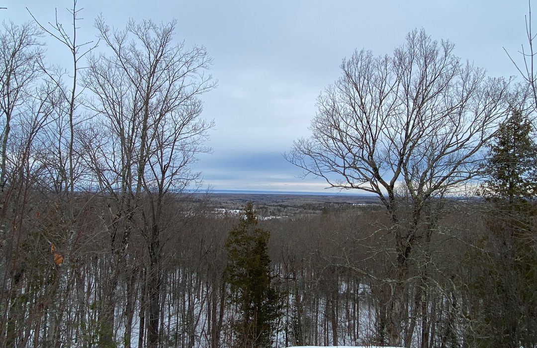
Cross Country Skiing & Snowshoeing
Looking for skinny ski sweetness? For cross-country skiing, head to these Northwoods destinations for some serious and very affordable winter wonder. You can also strap on some snowshoes and slip into the quiet wonders of the wild.

Superior Municipal Forest
With 8 loops, these gorgeous trails are tracked and groomed seven days a week for skate and classic skiing. Plus, spots for skijoring. Beginner to advanced trails. Day or season pass.
Brule River State Forest Afterhours Trail
7 miles out and back, this rooted single track follows the Pokegama River in the Superior Municipal Forest.
Douglas County Trails
104 miles of multi-use gravel trail passes through remote areas of northwest Wisconsin rich in wildlife habitat. The trail crosses numerous rivers and streams, including the Namakagon River.
Pattison State Park
104 miles of multi-use gravel trail passes through remote areas of northwest Wisconsin rich in wildlife habitat. The trail crosses numerous rivers and streams, including the Namakagon River.

Ways to roam
National Water Trail
Get a new perspective on the head of the Great Lakes from the seat of a kayak or canoe. Paddle the St. Louis River Estuary National Water Trail to experience a massive river estuary amid the Twin Ports urban landscape. Follow a map designed with 11 loop trails for all skill levels and abilities—as well as any watercraft.
National Water Trail
Get a new perspective on the head of the Great Lakes from the seat of a kayak or canoe. Paddle the St. Louis River Estuary National Water Trail to experience a massive river estuary amid the Twin Ports urban landscape. Follow a map designed with 11 loop trails for all skill levels and abilities—as well as any watercraft. Water Trail Map
open To All
Whether you enjoy walking, running, rollerblading, biking or riding your ATV/UTV or snowmobile, these trails in the heart of Superior let you explore urban and wild areas with ease. Bring your furry best friend and woof it up at the Superior Dog Park.
Many Uses
Whatever the season, go ahead and explore more. Multi-use trails like the Tri-County Corridor, which joins the popular Osaugie Trail at the eastern edge of Superior, provide options for cycling, ATV, snowmobile and beyond. Gravel-surfaced, the abandoned railbed runs 60 miles to Ashland past scenic Amnicon Falls State Park.
Get After It
Hundreds of thousands of acres of forest to explore. Parks galore. And oh, the water. Did we mention the water? For camping. Fishing. Paddling. Exploring. For waterfalls and wildlife. You gotta see this. View Parks
