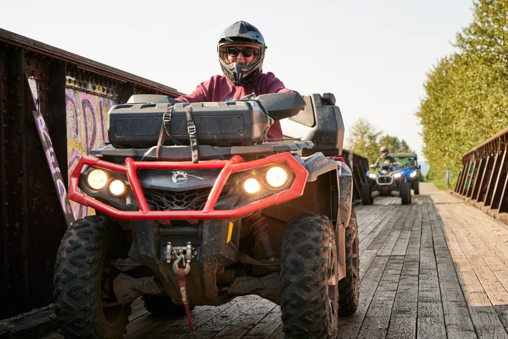
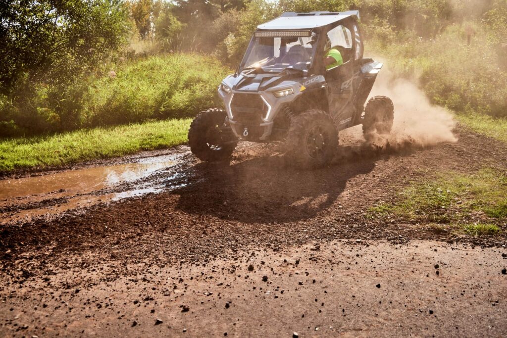
100+ miles of trail, stunning northwoods scenery, and zero parking headaches. This is ATV/UTVing the easy way.
Pull into town, get your bearings, and you’re already minutes from the trails. No long hauls to a trailhead. No arguing about who forgot to check the map.
The City of Superior’s trail system links directly to the broader Douglas County ATV/UTV network covering over 100 miles! – which means your fun starts the moment you park.
Let’s go!

Your Trail–by–Trail Guide
Everything you need to plan your ride is right here.
In this guide:
- Tri-County Corridor
- Wild Rivers State Trail
- Gandy Dancer State Trail
- Saunders State Trail
- Lodging
- Trailside Stops
- Waterfalls (side quest to see the tallest in the midwest!)
- Know Before You Go (Passes, Safety, City/County Info)
- Quick links + Map Resources
Whether you’re planning a quick weekend ride or a full week in the saddle, this is your starting point.
Ready. Set. Braaap!👇
Tri-County Corridor: The Crown Jewel
If you ride one trail in Douglas County, make it this one.
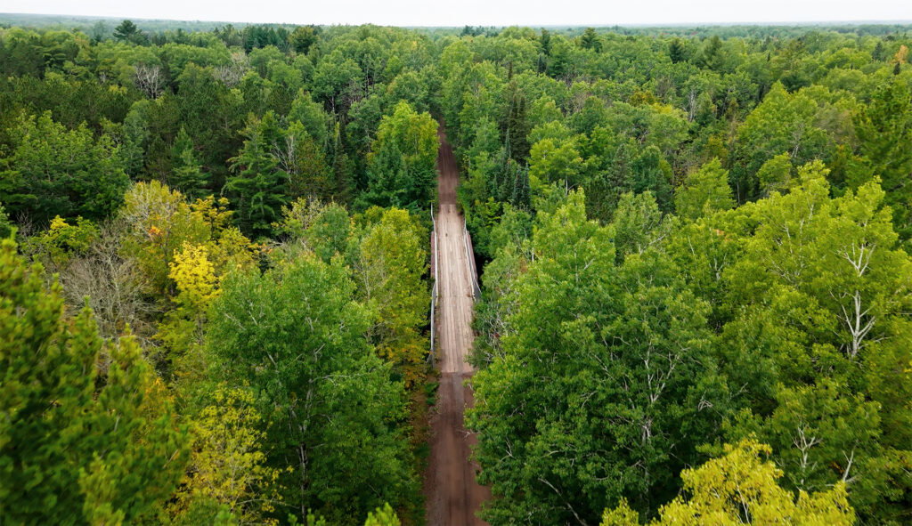
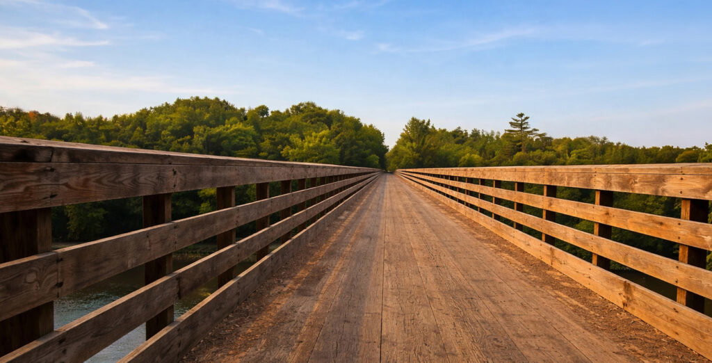
The Tri-County Corridor runs 60 miles from Superior all the way to Ashland, passing directly through Amnicon Falls State Park. The Amnicon River splits three ways, and a 55-foot covered bridge spans the water between two gorgeous waterfalls. Not a bad place to take a breather.
Built on crushed limestone and cutting through Ashland, Bayfield, and Douglas counties, this trail was practically designed for the rider who wants big scenery without technical headaches. Deer wander the birch trees. Bridges rise over churning rivers. Enjoy!
Tri-County Corridor Specs
Length: 62 miles (Superior to Ashland, Wisconsin)
Difficulty: Easy
Surface: Crushed limestone
ATV/UTV Season: Spring through Fall
Counties: Douglas, Bayfield, Ashland
Trail Highlights: Passes directly through Amnicon Falls State Park; trailside dining and lodging throughout; connects to the Osaugie Trail at the eastern edge of Superior; old railroad trestles and river crossings along the route.
Trailhead in Superior: Moccasin Mike Road parking lot, off US-53 south
More Info: Travel Wisconsin – Tri-County Corridor
Rest Stops Along the Way: Towns along the route include Poplar, Maple, Brule, Iron River, and Moquah before ending in Ashland. Amnicon Falls State Park and the Amnicon Bar are right on the corridor – built-in rest stops you’ll be happy to make.
Wild Rivers State Trail: 104 Miles of Easy
This one’s a crowd-pleaser for good reason.
Stretching 104 miles across Barron, Douglas, and Washburn counties, the Wild Rivers Trail is a well-maintained, highway-grade compacted gravel – smooth, accessible, and absolutely loaded with natural scenery and wildlife habitat.
Wild Rivers State Trail Specs
Length: 104 miles total (Douglas, Washburn, & Barron counties)
Difficulty: Easy
Surface: Compacted gravel
ATV/UTV Season: Open year-round
Trail Highlights: Runs north-south from Superior through Solon Springs, Gordon, Minong, Trego, Spooner, and Haugen to Rice Lake; crosses the Namakagon River (a federally designated St. Croix National Scenic Riverway); excellent wildlife viewing, including white-tailed deer and eagles; good beginner and family trail.
Trailhead near Superior: Near the intersection of County Highway C and County Highway A, just south of Superior
More Info: Wisconsin DNR – Wild Rivers State Trail
Rest Stops Along the Way: Towns along the route include Solon Springs, Gordon, Minong, Trego, Spooner, and Haugen. Solon Springs is your first stop heading south from Superior – a good spot to fuel up before you go.
Gandy Dancer State Trail: The One That Crosses State Lines
For the rider who likes a good story to tell at dinner.
The Gandy Dancer runs 31 miles through Minnesota before crossing back into Douglas County for another 15 miles. The highlight? A 520-foot bridge over the scenic St. Croix River near Danbury. ATV/UTVs are welcome year-round on the Douglas County portion.
Yes, you can technically say you rode into Minnesota. Yes, it totally counts.
Gandy Dancer State Trail Specs (North Segment)
Length: 15 miles (Douglas County segment); 31 miles continuing into Minnesota
Difficulty: Easy
Surface: Gravel railroad grade
ATV Season: Year-round (Douglas County portion)
Trail Highlights: Crosses into Minnesota and back – the only trail in Douglas County that lets you say you rode in two states; features a dramatic 520-foot bridge over the St. Croix River near Danbury; flat terrain with pine and poplar forest views; connects to Saunders State Trail in Douglas County.
More Info: Wisconsin DNR – Gandy Dancer Trail (North)
Rest Stops Along the Way: Danbury is the main town along the North Segment of this route. Services are limited on this segment. Pro Tip: Fuel up before you head out – this trail is scenic and a must-ride, but rest stops are few and far between.
Saunders State Trail: The Connector
The trail that holds the whole system together.
Eight miles of county-operated trail linking the Gandy Dancer to the broader network south of Superior. The Saunders passes through Boylston Junction, Boylston, and Borea, crossing Clear Creek and the Pokegama River along the way. It’s open year-round for ATV/UTVs.
Saunders State Trail Specs
Length: 8 miles
Difficulty: Easy
Surface: Gravel railroad grade
ATV Season: Year-round
County: Douglas
Trail Highlights: This trail links the Gandy Dancer to the broader Douglas County system south of Superior; passes through Boylston Junction, Boylston, and Borea; crosses Clear Creek and the Pokegama River. Starts near the intersection of State Highway 35 and County Highway C.
More Info: Wisconsin DNR – Saunders State Trail
Rest Stops Along the Way: This route passes through the small communities of Boylston Junction, Boylston, and Borea. Pro Tip: Pack snacks and top off your tank before hitting this one – it’s a connector trail with minimal services along the way.
Lodging
Superior has you covered when it comes to a good night’s sleep after a long day in the saddle. Here’s where to start.
Barkers Island Inn – Direct Access to Tri-County Corridor
300 Marina Drive, Superior | Waterfront | Full-service hotel | On-site dining
Barkers Island Inn is a full-service waterfront hotel on Lake Superior with on-site dining and direct access to both the Osaugie Trail and the Tri-County Corridor – meaning you can ride out straight from the property. It’s the kind of base camp that makes a good trip feel like a great one.
More Info: Barkers Island Inn
More Superior Stays
Superior has a solid range of lodging options to fit every style and budget.
→ Browse the full list of places to stay.
Trailside Stops Worth Knowing
The Douglas County trail network has no shortage of trailside businesses – but these two are ATV institution status.
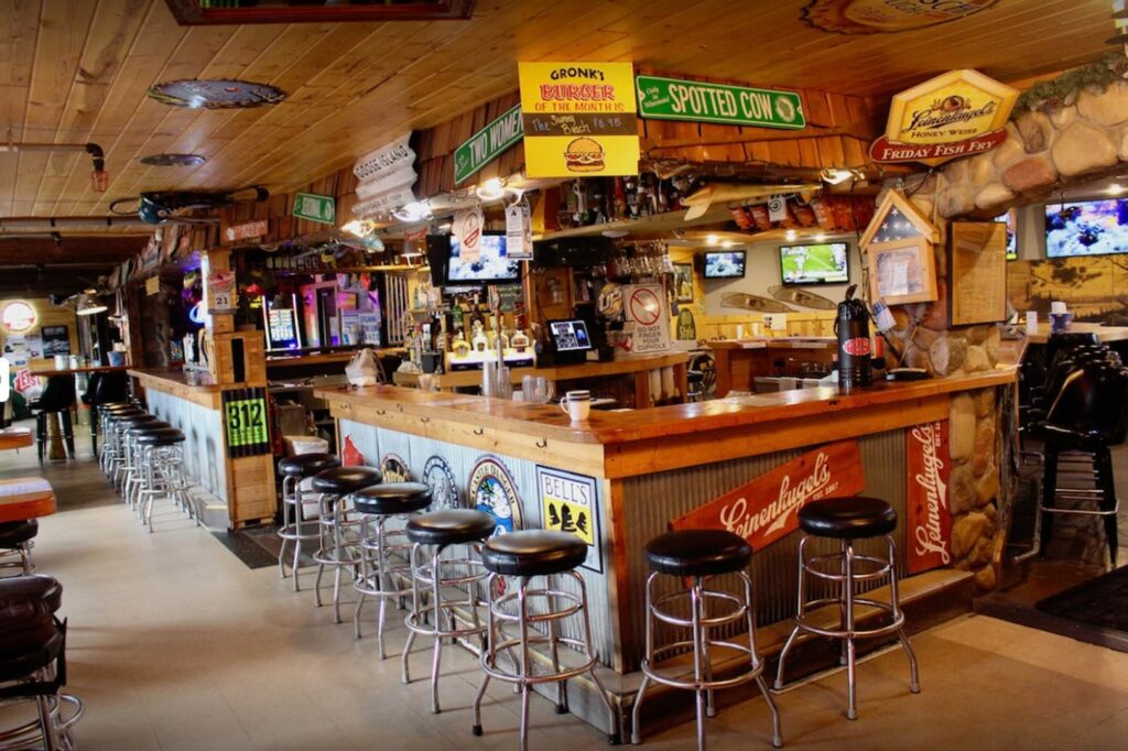
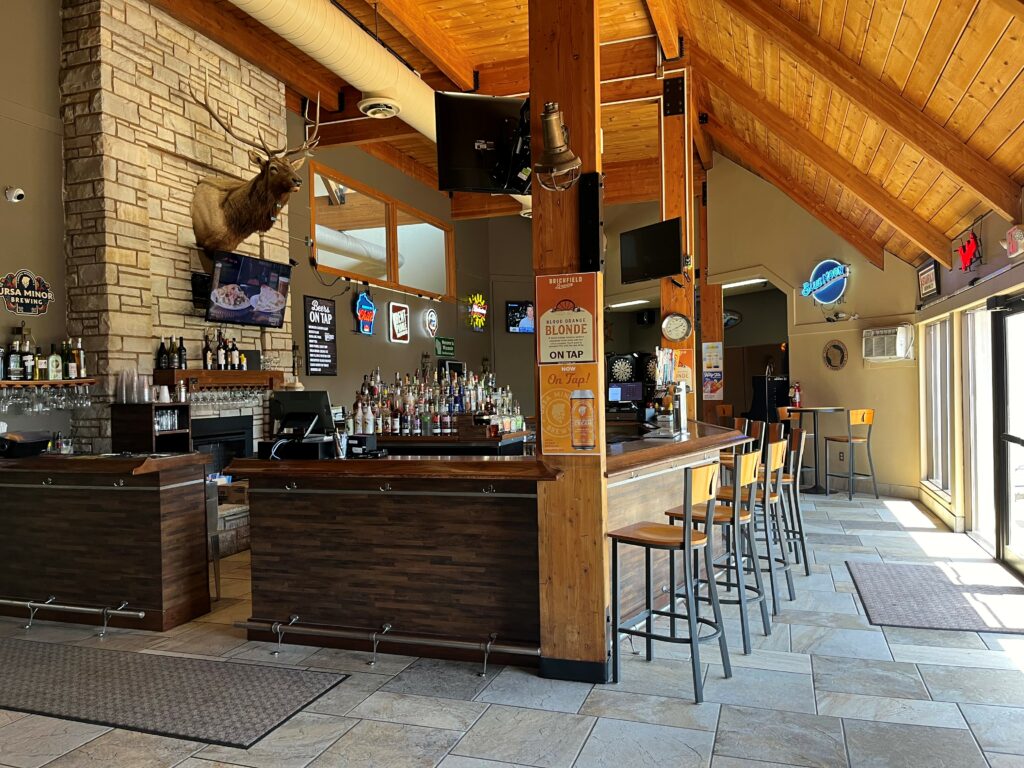
Gronk’s Grill & Bar – Superior
4909 E. 2nd Street, Superior | Direct ATV trail access
Right at the southern gateway to the city trail system, Gronk’s is the kind of place that earns its reputation the old-fashioned way – big portions, cold beer, 22 taps, and the legendary upside-down burger. Featured by name on Discover Wisconsin’s ATV destination list. If you ride out of Superior, there’s a good chance you’ll end up here.
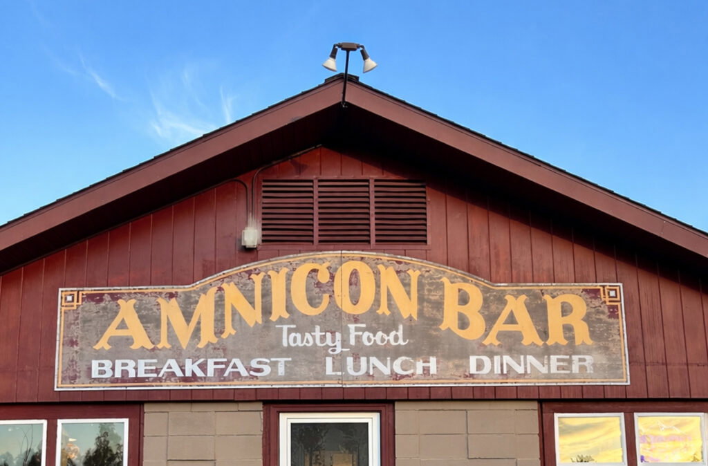
Amnicon Bar & Restaurant
7794 S County Road A, Superior | On the Tri-County Corridor | Open May–October
Sitting right on the Tri-County Corridor, the Amnicon Bar is exactly the kind of stop a trail was made for. Known for broasted chicken, fish fry, big breakfasts, and a genuinely warm welcome for ATV groups. Open seasonally with daily specials and takeout available. One reviewer put it perfectly: “a great place to stop for a pop while on the ATV.” That’s all the review you need.
Waterfalls ON and OFF the Trail
It’s not every ATV trail system that routes you past a genuine waterfall.
The Tri-County Corridor does – and if you can pull yourself away from the trail for an afternoon, Wisconsin’s tallest waterfall – Big Manitou Falls is just a short drive away!
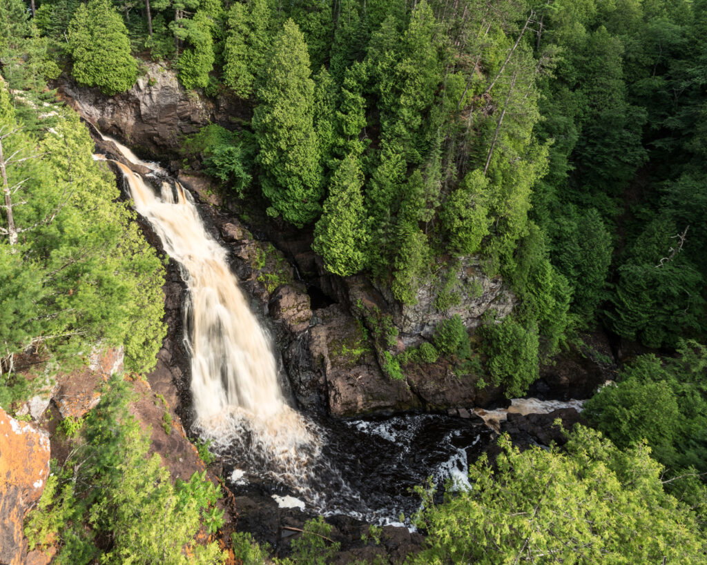
OFF the Trail (WI’s Tallest!)
When you’re ready to park the machine for a few hours, Pattison State Park is about 13 miles south of Superior and home to Big Manitou Falls – at 165 feet, the tallest waterfall in Wisconsin. The park also has Little Manitou Falls, a 300-foot beach on Interfalls Lake, and nearly 200 species of birds. It’s not on the ATV trail, but it’s absolutely worth the drive. Think of it as the perfect way to stretch your legs between riding days.

ON the Trail
Amnicon Falls State Park, right on the Tri-County Corridor, has its own covered bridge and hardwood forest trails through meadows of wildflowers and dense balsam fir. You’ll ride through it. You should stop in it.
Know Before You Go (The Practical Stuff)
Nobody wants a surprise at the trailhead. Here’s what you need to know:
Trail Pass: Out-of-state riders need a Wisconsin DNR nonresident ATV/UTV trail pass. Annual pass: $35. A 5-day pass is also available. Buy it online before you leave home at gowild.wi.gov. Affix it visibly on the forward half of your machine.
Safety Certification: Anyone born after January 1, 1988, must pass a Wisconsin DNR ATV safety course to ride on public trails. The online course takes a few hours and costs around $35 – do it before you head north. Take it at offroad-ed.com/wisconsin.
In the City of Superior: All operators 16+ need an ATV safety certificate. Headlights and taillights on at all times. Slow to 10 mph or less within 100 feet of non-motorized trail users. See the City of Superior Motorized Trail Map for city routes.
Trail Conditions Hotline: Call the Douglas County Trail Hotline 24/7 at (715) 378-4528 before heading out – especially in spring when trails close to prevent erosion and fire risk.
Spring Closures: Trails close seasonally to protect the base and during DNR red flag fire danger periods. Always check the hotline or the Douglas County Recreational Trails page before your trip.
Quick Links & Map Resources
Bookmark these before you go:
• Douglas County ATV Trail System (official trail info + conditions)
• Douglas County Recreational Trails Overview
• Douglas County ATV Trail Map (Avenza Maps – iOS & Android)
• Douglas County ATV Trails on Travel Wisconsin
• Buy Your Nonresident ATV/UTV Trail Pass – Go Wild (Wisconsin DNR)
• Wisconsin ATV Safety Certification Course Online – offroad-ed.com
• Wisconsin DNR ATV/UTV Information Hub
• Superior Chamber & Visitors Bureau – ATV Page
• Amnicon Falls State Park | Pattison State Park (Big Manitou Falls)
• Douglas County Trail Hotline: (715) 378-4528 – available 24/7
How Far Is It, Really?
From Eau Claire, you’re looking at about 2.5 hours. That’s a Friday afternoon drive that has you riding before dinner.
From Madison, it’s right around 5 hours – which is exactly the kind of distance that makes a full weekend feel worth it. Drive up Friday, ride all day Saturday, squeeze in a morning ride Sunday, and be home by dinner. That’s a real trip.
From anywhere else, Superior’s not far – Check it out on Google Maps!
Plan Your ATV Trip
You’ve gotta ride these trails, eat the food, and enjoy summer like the locals do. Just bring your wheeler and a good playlist for the drive up.
Browse lodging options and start planning your ride.
